Data source: United Nations Statistics Division (UNSD)
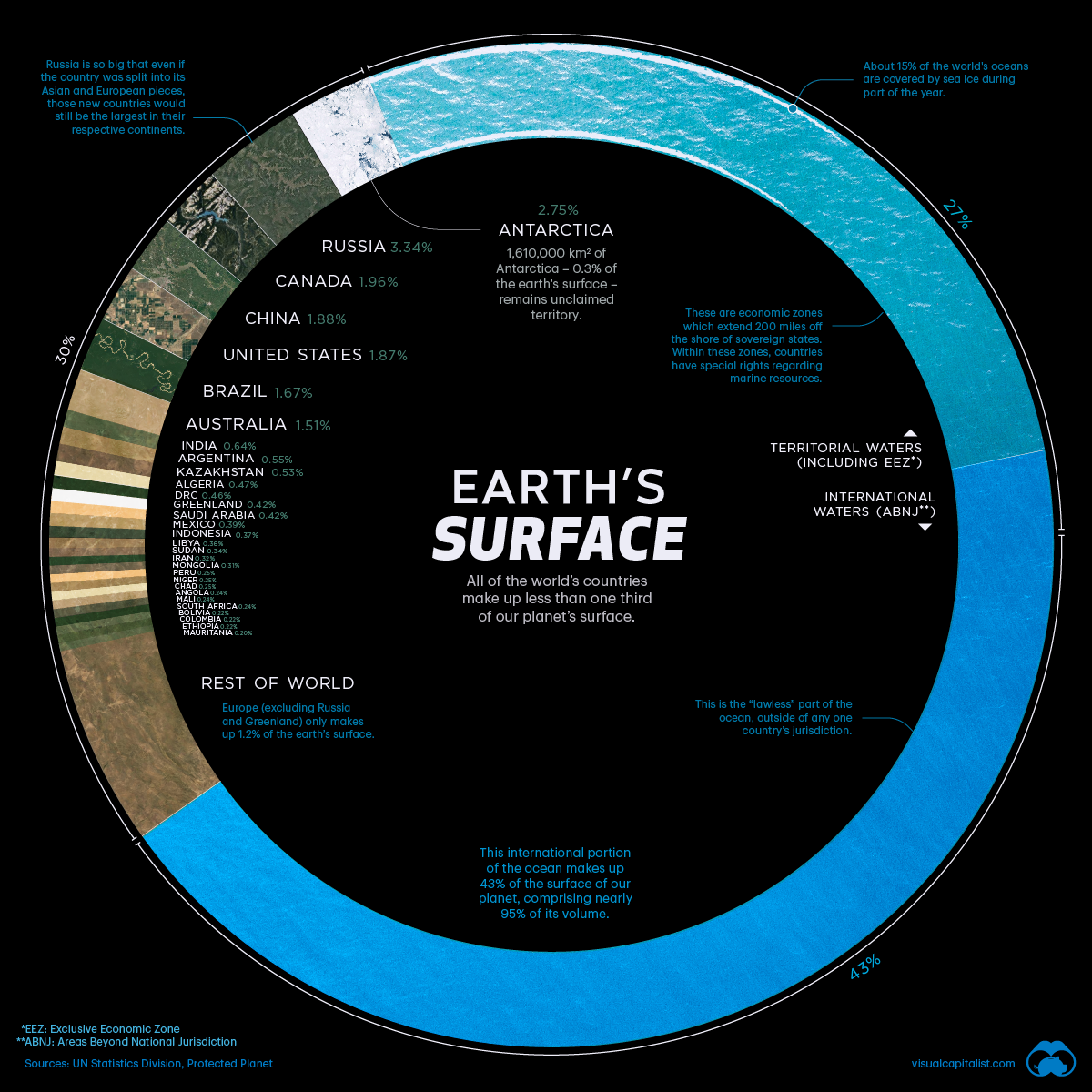
The Earth’s surface covers more than 510 million square kilometres, but less than 30% of this surface is covered by land. This visualisation uses data mainly from the United Nations Statistics Division (UNSD) to rank the countries of the world according to their share of the Earth’s surface.
Distribution of countries according to their share of the Earth’s surface
The largest countries in terms of area are Russia (3.35%), Canada (1.96%) and China (1.88%). Together they occupy about 7.2% of the Earth’s surface. Russia is so large that even if the country were divided into its Asian and European sections, these new regions would still be the largest on their respective continents.
Antarctica, although not a country, covers the second largest global area at 2.75%. Other nations that exceed the 1% land area mark are the United States (1.87%), Brazil (1.67%) and Australia (1.51%).
The remaining 195 countries and regions, with an area of less than 1%, together account for the other half of the Earth’s surface.
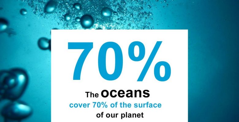
The remaining 70% of the Earth’s surface is water, with 27% being territorial waters and 43% being international waters or areas beyond national jurisdiction.
Sources : UN Statistics Division, Protected Planet
Areas beyond national jurisdiction
In the past, nations adhered to the doctrine of the freedom of the sea, a 17th century principle that limited jurisdiction over the oceans to a narrow area along a nation’s coastline. The rest of the seas did not belong to any nation and countries were free to travel and exploit them.
This situation continued until the 20th century but, by mid-century, efforts were being made to expand national claims as competition for offshore resources became increasingly fierce and ocean pollution became a problem.
In 1982, the United Nations adopted the Convention of the Law of the Sea, which extended international law to offshore waters. The convention established freedom of navigation rights and set the limits of the territorial sea at 12 miles (19 km) offshore, with exclusive economic zones up to 200 miles (322 km) offshore, extending a country’s influence over maritime resources.
The size of countries is the result of politics, economics, history and geography. In other words, borders can change over time.
In 1946 there were 76 independent countries in the world, today there are 195. There are forces that bring landscapes together or apart over time. If physical geography plays a role in the identity of nations, Sheikh Zayed bin Sultan Al Nahyan, former ruler of the United Arab Emirates, a tiny Gulf nation, put it well:
“A country is not measured by the size of its area on the map. A country is truly measured by its heritage and culture.”