Last June, the 10th oceanographic campaign of the MOOSE network took place in the Mediterranean Sea. For more than a decade, the LOCEAN laboratory, the marine stations of Roscoff, Banyuls, Villefranche-sur-mer of Sorbonne University, the MIO laboratory and CEFREM have been involved in this Mediterranean Ocean Observing System for the Environment financed by CNRS-INSU and the ILICO Research Infrastructure. A unique integrated and multidisciplinary network in charge of observing and understanding, in a sustainable way, the evolution of a Mediterranean basin undergoing major consequences of climate change and human activities.
The Mediterranean, in the “spotlight” for global marine biodiversity and climate change
Spanning more than 24 countries and territories in Europe, North Africa and the Middle East, the Mediterranean Sea is the largest semi-enclosed sea in the world. With its 46,000 km of coastline, it is subject to strong and increasing human pressure, generated by the activity of 150 million inhabitants and the influx of 200 million tourists annually, the consequences of which are uncontrolled: urbanisation, tourism, maritime traffic, pollution and overexploitation of resources in particular.
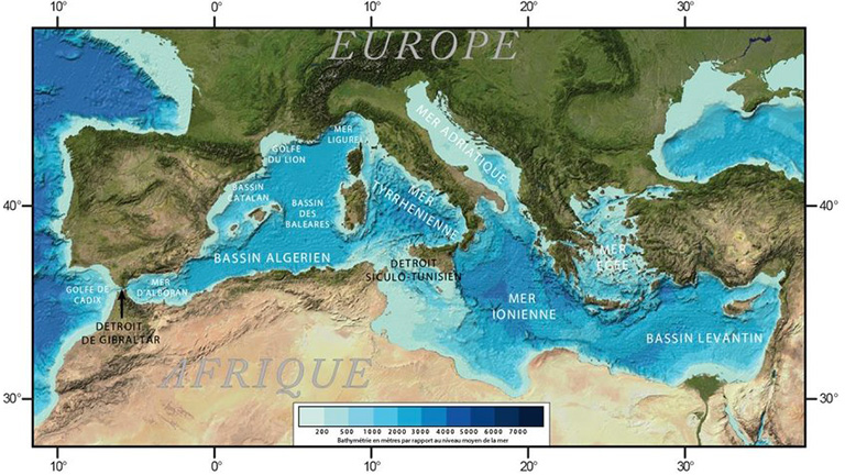
Geomorphological map of the Mediterranean Sea © GEBCO
From a hydrographic point of view, its quasi-enclosed sea and its geographical position make it one of the saltiest seas in the world, with higher than normal evaporation of its waters due to its climate. The Mediterranean is also a sea with a fast thermohaline circulation (10 times faster than the global ocean) that is warming much faster than normal, with for example a 1°C increase over 30 years for the surface temperature. As a result, sea level rise is predicted to exceed one metre by 2100.
The north-western part of the Mediterranean basin, bounded by the Ligurian Sea, the Gulf of Lion and the Provençal basin, is particularly dynamic and responds rapidly and amplified to climate change and its multiple consequences: The long-term observation of the evolution of the hydrological balance of this north-western Mediterranean basin is therefore crucial to better understand it and to be able to predict the global impacts of climate change.
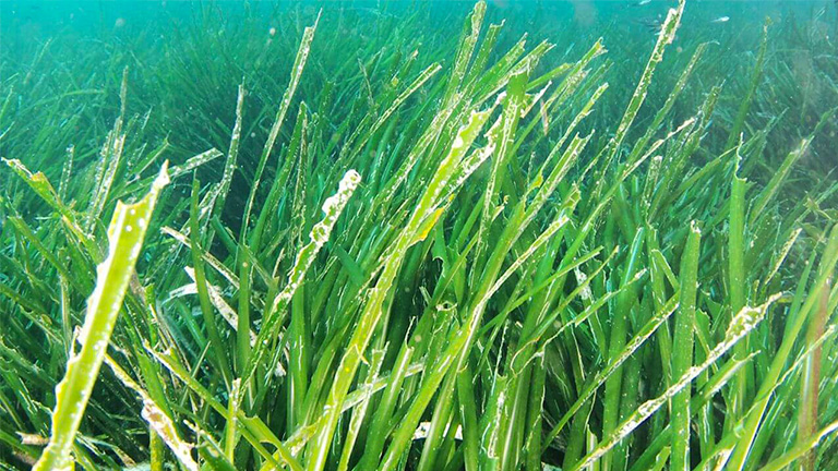
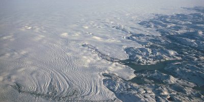
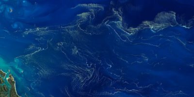
Posidonia seagrass in the Mediterranean
MOOSE, a unique network for the observation of the north-western Mediterranean basin
Dotted with numerous islands and underwater banks, the Mediterranean is also one of the major reservoirs of marine and coastal biodiversity. Although it represents only 1% of the planet’s waters, it is home to more than 10,000 marine species, with 28% of endemic species, 7.5% of the world’s fauna and 18% of its marine flora.
Throughout the Mediterranean basin, exacerbated climate change combined with excessive anthropogenic pressure is having disastrous consequences for all marine biodiversity. The extent of the changes in fish species and key habitats is widely observed; the disappearance of certain unique Mediterranean species such as endemic Posidonia meadows or gorgonian corals threatens the entire marine ecosystem.
It is in this context that since 2010, an integrated and multidisciplinary network has been initiated in the North-Western Mediterranean under the aegis of the CNRS and the MISTRALS programme. The MOOSE (Mediterranean Ocean Observing System for the Environment) network is a regional network installed from the coast to the open sea, with a multi-site and multi-platform approach: fixed platforms such as CTD stations or instrumented moorings, mobile platforms such as gliders or Argo profiling floats.
Each network monitoring allows the collection of multiple and varied data :
- Coastal data associated with river inputs and atmospheric deposition ;
- Physical, chemical and biological marine data for monitoring biological communities, biodiversity, hydrodynamic and biogeochemical processes.
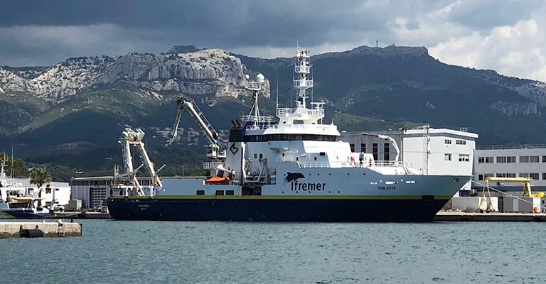
In June 2021, the 10th campaign of the MOOSE network took place on board the oceanographic vessel Thalassa of the French Oceanographic Fleet (FOF), which left from the port of La Seyne-sur-Mer. The north-western Mediterranean basin was criss-crossed for 24 days, resulting in 125 observation stations and the maintenance of 4 moorings.
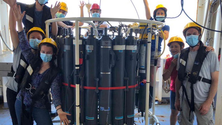
Part of the scientific crew aboard the 10th oceanographic campaign © MOOSE
Real-time and delayed-time data streams are accumulating decade after decade. They are essential to facilitate the validation of operational oceanographic models and to enable analysis and forecasting.
The establishment of scenarios of climate and ecosystem evolution in the Mediterranean is the key to exploring the future evolution of the Mediterranean in the face of climate change and anthropogenic pressures. In the long term, solutions must be found for the adaptation and resilience of human populations and marine species.
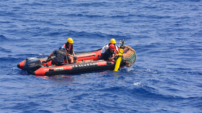
Recovery of a Bio-Argo profiling float during the 10th campaign © Laurent COPPOLA
As part of a European cooperation approach, the MOOSE project largely shares its scientific purposes with similar observatories deployed in Spain, Italy and Greece. The coordination of these observatories at the European level and their extension to other key areas such as the South and East of the Mediterranean Basin are the challenges of the future in order to have data allowing a global vision of the Mediterranean.